 EMODnet Product Catalogue
0.03125 Arc minute
Type of resources
Available actions
Topics
Keywords
Contact for the resource
Provided by
Years
Formats
Representation types
Scale 1:
Resolution
-
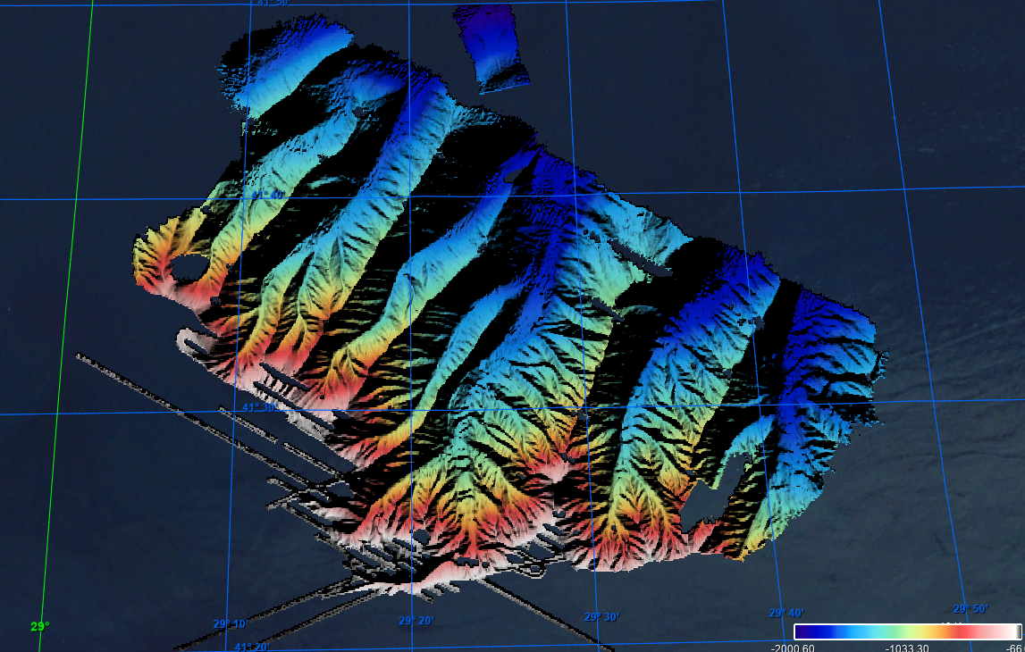
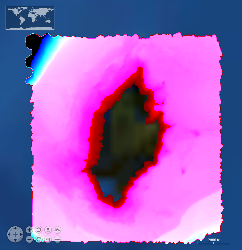
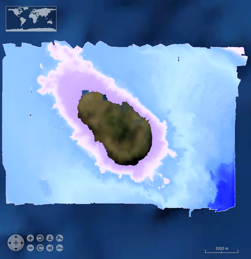
This Digital Terrain Model (DTM) is a high resolution bathymetry dataset that covers MEDOC survey. Multibeam data acquired in 2010 on board the R/V Sarmiento de Gamboa using an Atlas Hydrosweep DS-3 multi-beam echosounder.
-
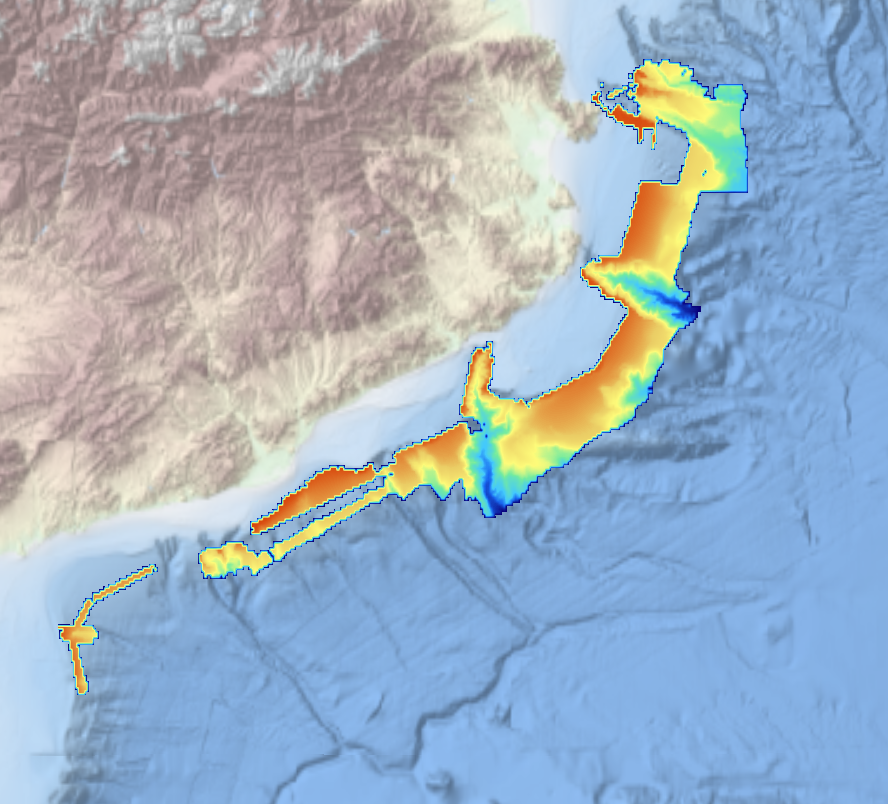
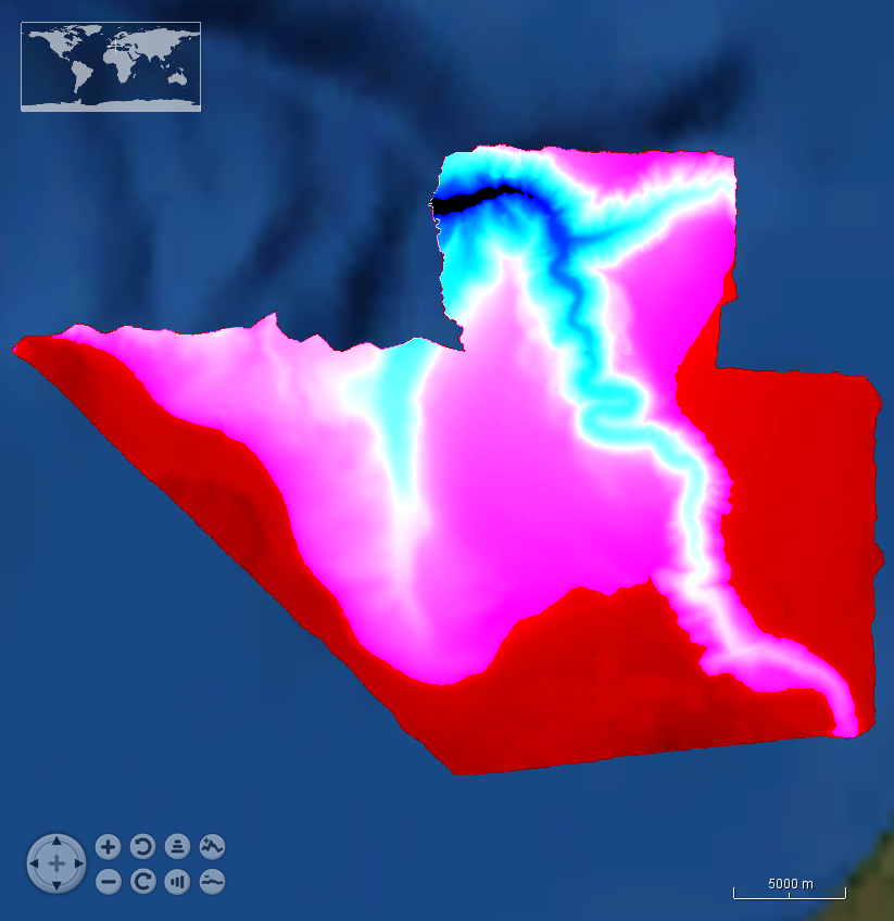
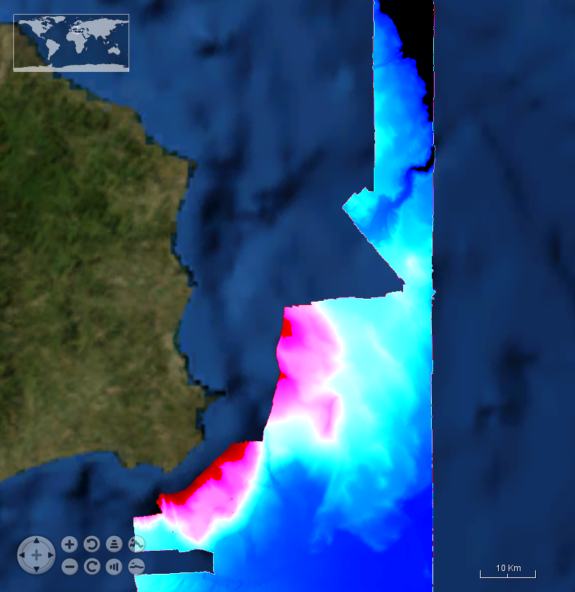
This composite Digital Terrain Model (cDTM) is a high resolution bathymetry dataset that covers bathymetry surveys INDEMARES-2, ABIDES-2, ABIDES-3, ABIDES-ROV and ABIDES-5 . Multibeam data acquired in 2010, 2017 and 2018 on board the R/V Garcia del Cid using a Elac Seabeam 1050D echosounder and in 2017 on board the Sarmiento de Gamboa using an Atlas Hydrosweep DS-3 multi-beam echosounder.
-
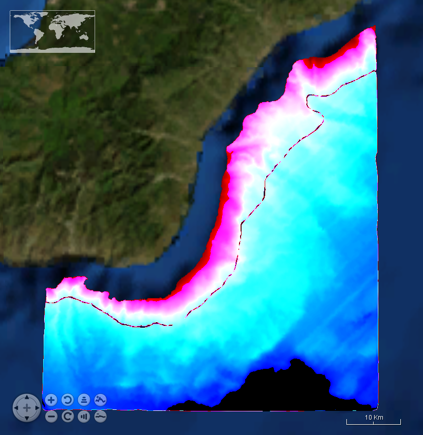
Grid processed for the purpose of the HR DTMs layer of EMODnet Bathymetry HRSM, October 2020
-
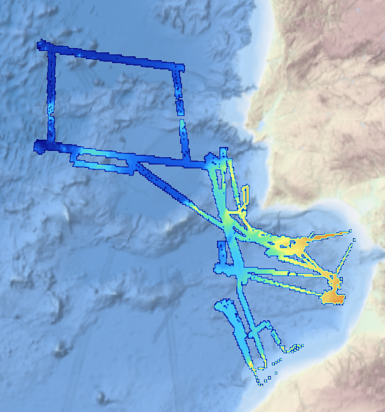
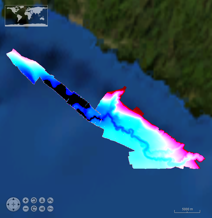
This composite Digital Terrain Model (cDTM) is a high resolution bathymetry dataset that covers bathymetry surveys INSIGHT_LEG1, FRAME-OBS, FRAME-MCS and INSIGHT_LEG2 . Multibeam data acquired in 2018 and 2019 on board the R/V Sarmiento de Gamboa using an Atlas Hydrosweep DS-3 multi-beam echosounder.
-
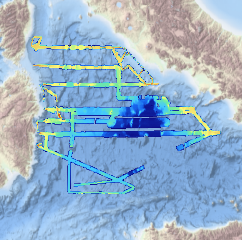
Systematic survey performed by ITS GALATEA with Multibeam EchoSounder
-
Systematic survey performed by Italian Navy Hydrographic vessels with Multibeam EchoSounder
-
Systematic survey performed by ITS MAGNAGHI with Multibeam EchoSounder
-
Systematic survey performed by Italian Hydrographic vessels with Multibeam EchoSounder
-
Systematic survey performed by Italian Navy Hydrpgraphic vessels with Multibeam EchoSounder
-
Systematic survey performed by ITS MAGNAGHI with Multibeam EchoSounder Simrad EM3002